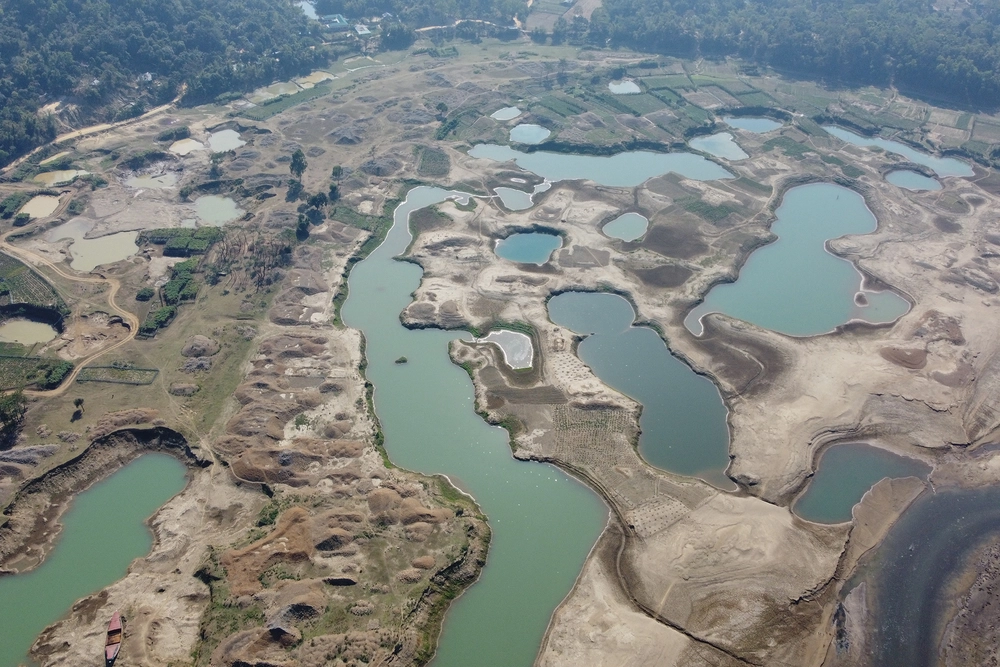
A new study using multidecade satellite imagery and face-to-face human interviews tracked the environmental and societal impacts of gravel mining in the Lubha River, Northeast Bangladesh. The researchers found that the river had recovered its natural shape within just four years after gravel mining stopped. However, the local economy did not bounce back nearly as quickly.
The study, published in the journal Cell Reports Sustainability, documents both environmental and societal outcomes and offers recommendations for the extraction of natural resources while minimizing their burden on the land and the people who live there.

University of Illinois Urbana-Champaign professor Jim Best, who’s research involves using satellite imagery to study the mutual relationships between rivers and people, collaborated with U. of I. graduate student Sadiul Chyon and Shah Atiqul Haq from Shahjalal University, Bangladesh, to highlight that decades of research have shown that mining too much sediment too quickly changes the river shape and ecology, and causes highly accelerated rates of downstream erosion.
The new methodology uses historical and contemporaneous satellite imagery to monitor landscape changes and estimate the number of migrant workers involved in gravel mining. This, combined with interviews with the locals and an environmental pressure group, helped develop a design for a fairer, more sustainable model for river sediment extraction in the Lubha River.
Learn More About How Locals Interact With Resource Extraction